TcpGPS Lite 1.5.1
Free Version
Publisher Description
Fast Surveys with Tablet or Smartphone.
INTRODUCTION
This application, installed on a mobile device with Android operating system, allows the user to make surveys using integrated GPS with its nominal precision, in a fast and easy way.
It can be used by surveyors and other technicians for surveys consisting on measuring lots, paths, crops, pipes, electrical lines, urban furniture...
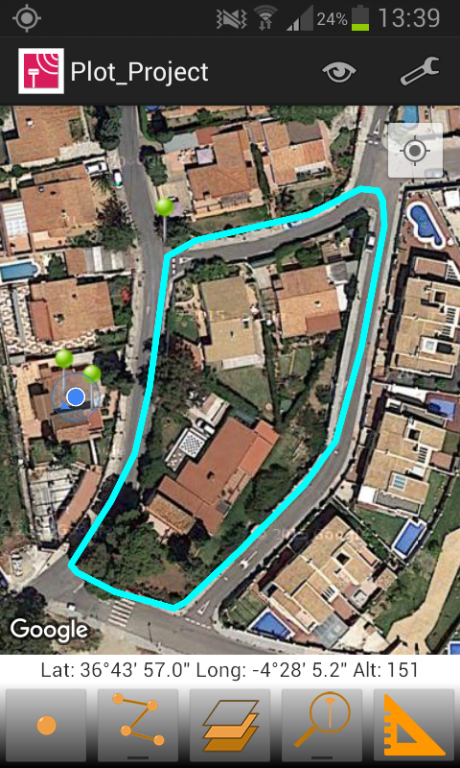
Google MapsTM is used as background, and can be represented in standard, satellite, hybrid and relief modes. Geographic or UTM projected coordinates are shown at all times.
POINT SURVEY
The application allows data collection of single points, whose coordinates are got from the GPS, showing the estimated precision by a circle, as is usual in location-based programs.
The points are automatically numbered and is registered the latitude, longitude and date/time. Optionally, you can be separated into different layers and also you can be associated to a picture, a comment and codes to differentiate it. The application stores the values most habitually to these codes and allows choosing them from a quick list.
CONTINUOUS SURVEY
It is also possible to perform a continuous survey, recording vertices automatically by an interval of time, distance or height difference.
At any time you can view the polyline data, such as minimum and maximum heights, length and area. Vertex information can be displayed as well.
You can work with multiple layers, with different names and colors.
MEASURING DISTANCES
From control panel also it is available the tool for measuring distances, through which, you can measure distances between vertices of a polyline or between a points that you have captured previously.
RESULTS
The result can be stored on several files, depending which you have selected.
KML file, for Google Earth.
DXF file, for CAD software.
TXT file
All this files can be sent by email from the application, through menu and selecting “Export Files”. Besides, these files can be sent through of Bluetooth, WiFi or LAN, from the app.
These files can also be imported by TcpMDT and other CAD and GIS applications.
SETTINGS
Editing preferences lets you to change the appearance of map, points and lines captured. It also sets parameters for data collection, information displayed in real time and others.
REQUIREMENTS
• Operating System: Android 4.0.3 or higher
• Integrated GPS
• Touch screen
• Internet access
About TcpGPS Lite
TcpGPS Lite is a free app for Android published in the System Maintenance list of apps, part of System Utilities.
The company that develops TcpGPS Lite is APLITOP. The latest version released by its developer is 1.5.1.
To install TcpGPS Lite on your Android device, just click the green Continue To App button above to start the installation process. The app is listed on our website since 2016-04-11 and was downloaded 1 times. We have already checked if the download link is safe, however for your own protection we recommend that you scan the downloaded app with your antivirus. Your antivirus may detect the TcpGPS Lite as malware as malware if the download link to com.aplitop.tcpandroidlite is broken.
How to install TcpGPS Lite on your Android device:
- Click on the Continue To App button on our website. This will redirect you to Google Play.
- Once the TcpGPS Lite is shown in the Google Play listing of your Android device, you can start its download and installation. Tap on the Install button located below the search bar and to the right of the app icon.
- A pop-up window with the permissions required by TcpGPS Lite will be shown. Click on Accept to continue the process.
- TcpGPS Lite will be downloaded onto your device, displaying a progress. Once the download completes, the installation will start and you'll get a notification after the installation is finished.
